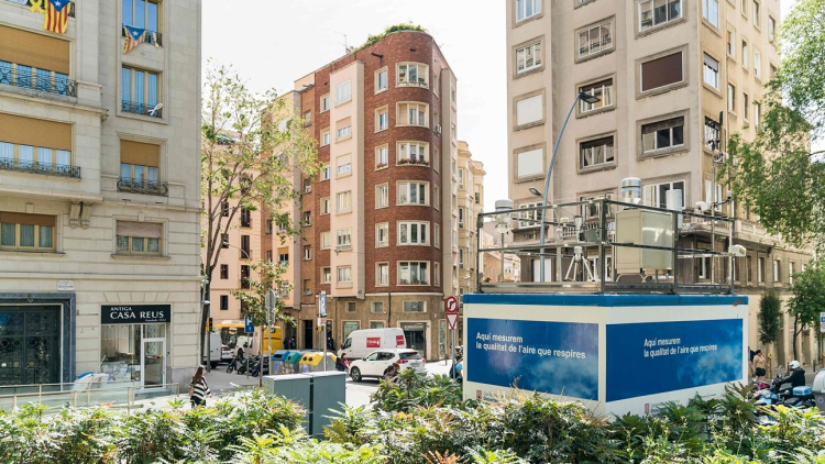
Atmospheric pollution monitoring and forecasting network
In Barcelona, 10 stations make up the Atmospheric Pollution Monitoring and Forecasting Network and they measure the air concentration of the main environmental pollutants that are harmful to people’s health. The data, along with other meteorological units and physical chemistry dispersion, is computer-processed and information on the pollutants in each area of the city is provided.
The stations monitor over 10 pollutants, including carbon monoxide, benzo[a]pyrene and heavy metals. It does not control the focus of the emissions, but it monitors the levels of concentration of pollutants in the air we breathe.
The stations in Barcelona are located in places that represent different street categories. Thus, the registers obtained can be extrapolated to other areas with similar urban conditions.
The stations can be divided into two types: urban-area stations and traffic stations.
- Urban-area stations: Palau Reial, University Area, Sants, Parc de la Ciutadella (IES Verdaguer), Poblenou, Vall d’Hebrón.
- Traffic stations: Eixample, University, Gràcia – Sant Gervasi
The Atmospheric Pollution Monitoring and Forecasting Network is co-managed by the Government of Catalonia and the Barcelona Public Health Agency.
Classification of the Barcelona Air Quality Condition (EQAB)
To facilitate the understanding of the level of Barcelona air quality in real time a six level classification has been established. These levels, represented with a colour code, range from good to extremely poor quality. Level scaling is based in Nitrogen Dioxide (NO2) and Particulate Matter (PM10) concentrations in the atmosphere.
The classification by levels is in accordance with the current definition of the Catalan Air Quality Index (ICQA)..
| EQAB | NO2 Maximum hourly (µg/m3) | PM10 Average per day (µg/m3) |
|---|---|---|
| Good | 0-40 | 0-20 |
| Fair | 41-90 | 21-40 |
| Moderate | 91-120 | 41-50 |
| Poor | 121-230 | 51-100 |
| Very poor | 231-340 | 101-150 |
| Extremely poor | more than 340 | more than 150 |


